With Fish Deeper Premium, anglers of all types have access to bathymetric charts of canals, rivers, ponds, gravel pits and lakes as long as they have been sounded by an angler with a Fish Deeper sounder subscribed to Fish Deeper Premium. This makes it easier for anglers to plan their fishing trips and exploit their chosen spots.
How can I use Fish Deeper Premium?
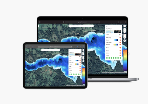
Fish Deeper Premium can be used with or without a fishfinder. If you have a Deeper fishfinder, you can use the service via your usual Fish Deeper application by subscribing. For others, you can access the service via the https://maps.fishdeeper.com website by subscribing as well. You'll then have access to all available bathymetric charts, i.e. all the locations sounded by owners of a Deeper sounder and a Fish Deeper Premium account.
The main features of Fish Deeper Premium
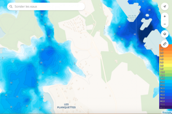
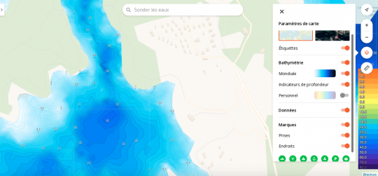
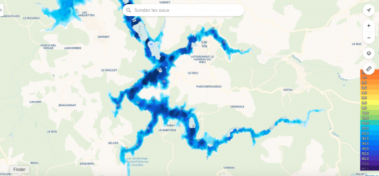
The primary feature of Fish Deeper Premium is access to global bathymetric maps of all locations surveyed by the Deeper community. On the world map, all these locations appear as blue dots. Simply zoom in or out to discover them.

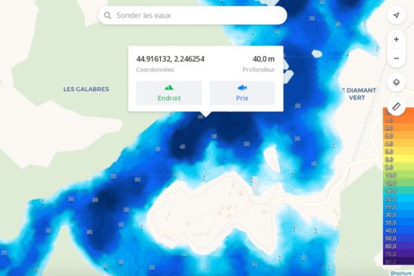
To help you quickly decipher the map, a depth scale remains on the screen. You can also type a location into the search bar to see if it is available as a bathymetric chart.
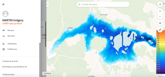
In addition, you can :
- Click on a spot to access its GPS coordinates. This gives you the depth and GPS point.
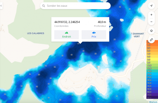
- Download bathymetric charts. You can then use them offline.
- Access weather forecasts for the chosen location: air temperature, wind speed, precipitation, pressure, humidity, visibility, cloud cover, UV index, sunrise/sunset and moonrise/moonset, with duration and phase respectively.

- Access information such as the percentage of premium coverage for the location, its surface area in Km2 and the number of kilometers of shoreline.
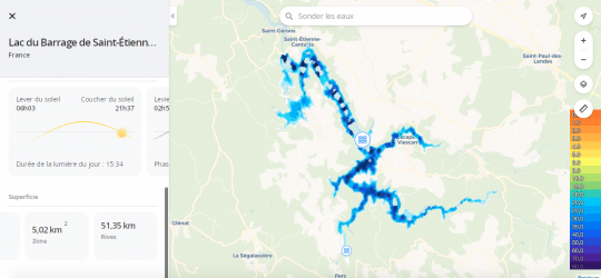
- Access various settings such as visual map selection, bathymetry selection (global, personal...), your data and marks.
- Measure distances.

Via the Fish Deeper application
When you use your Deeper fishfinder, you have access to premium charts and features, as well as the usual Fish Deeper functions. You can also access your personal data (my favorite waters, my catches, my locations, statistics, preferences...).


Guest mode
You can switch to guest mode on the location. For other locations, you'll switch back to normal mode.
How do I get access to Fish Deeper Premium?
- 3 months free for Deeper sounder owners.
- Yearly subscription to Fish Deeper Premium for 19.99 euros with 7-day free trial, which lets you see if the places you're fishing are mapped. - Monthly subscription for 4.99 euros.
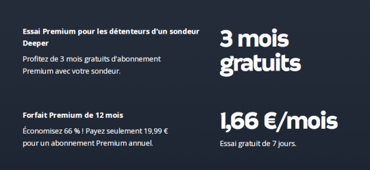

By subscribing to Fish Deeper Premium, you participate in the collective process of improving bathymetric charts with your global (not personal) data. And you'll have access to all the bathymetric charts in the Deeper community, as well as all the features that go with them.

 /
/ 
