A strategy to implement
On my fishing trips, whether for leisure or competition, my strategy is always the same. I systematically start by looking at the color and temperature of the water, which will enable us to imagine a comfort zone for the fish in a certain layer of water.
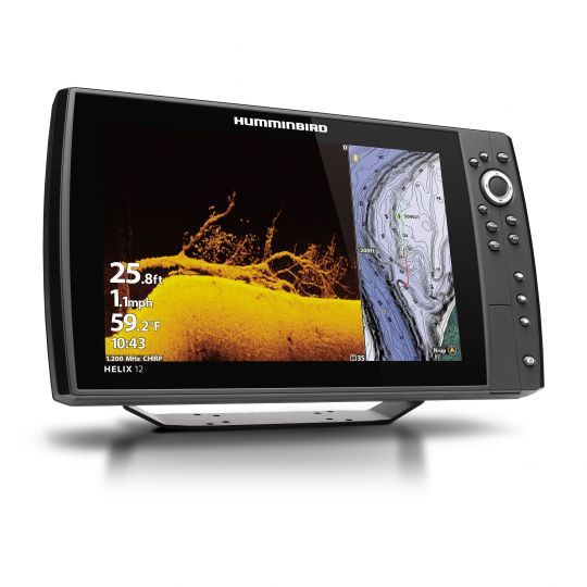
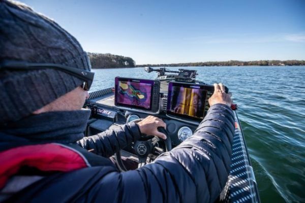
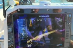
Following this analysis, I systematically launch a view that I greatly appreciate on the Helix, the view with all three technologies (DS Sounder, Mega Down Imaging, Mega Side Imaging).

This view will allow us to recover a huge amount of information in a very short time! Thanks to DS technology (2D chirp sounder), we'll be able to tell very quickly if there are fish in a particular spot. Remember that this technology has two frequencies, giving two angles of perception. A wide angle to find fish more quickly, and a narrow angle to be even more precise under the boat! Mega down Imaging (MDI) technology, which will be displayed right next to this DS image, will enable us to see the structures under the boat with extreme precision. In fact, the 2D sounder will display a graphic representation of the fish and structures on the screen, while the MDI will show us a "black and white" photo view of the seabed!
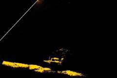
Take this submerged bridge, for example!
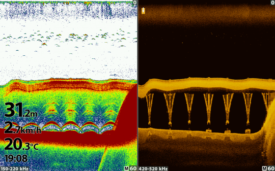
DS image (graphic representation) MDI image (photo representation)
MEGA DI technology for a sharper image
With the help of this technology, we'll quickly understand whether we're on a school of fish or a structure such as a wreck, rock, tree... As its name suggests, the MEGA DI is equipped with a 1000 khz frequency for extremely precise imaging.
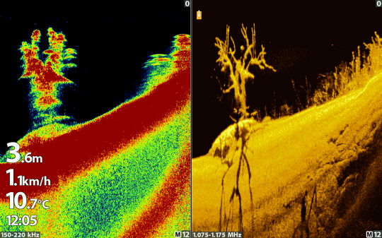
Here's a little Humminbird tip: depending on your fishing depths, you'll simply have to change this frequency to stay as accurate as possible. There's a quick button on your "v" device!
- In water depths of 0 to 10/15 m: 1000khz
- From 15 to 25 m: 800 khz
- And as a general rule, 20/25 m and up: 455 khz!
Mega Side Imaging, to save time
The third image in this view: Mega Side Imaging, one of my favorite technologies! This side view in black and white photo image will save us a considerable amount of time in finding the right area for the fish! Imagine a river like the Lot, for example, where the width is often 80m. Using the MSI view, we'll be able to set the lateral range to 30 m on each side, allowing us to survey almost the entire Lot in a single pass. In a single round trip, we'll know everything that lies beneath our boat, from the slightest break, to plateaus, seagrass beds and submerged trees.

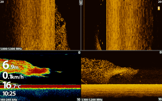
MSI technology also lets you see the fish! In this image, we can make out a large shoal of fish under the boat with DS and MDI, while with MSI, we can see that the shoal of forage fish is mainly on the left of the boat and the carnivores mainly on the right.
When a beautiful structure appears on the screen, we can move the cursor to place a GPS point very precisely on the area. Once that's done, I'll move straight on to the DS / cartography view.
This view is essential in my opinion, as it will enable us to return quickly to the GPS point we've just created and at the same time see on the DS sounder view on the left of the image whether the structure is actually underneath or whether there are fish as in the following capture.
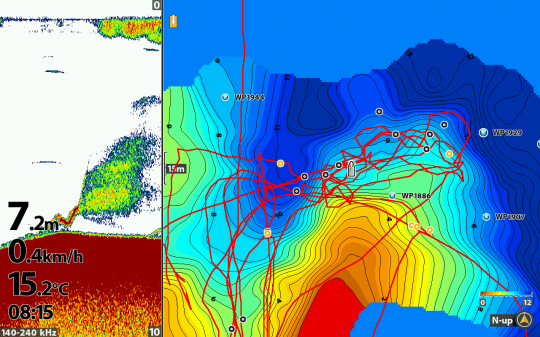
Humminbird's cartography view doesn't just give us this option! Thanks to this view, we'll be able to trace our drift back to the red line that was our track (our last passage), and we'll also be able to create a live bathymetric map of the seabed!
AutoChart Live and Ipilot LINK
In fact, thanks to the AutoChart Live technology present in all recent Humminbird devices equipped with GPS, we will be able to better analyze the relief and position the boat in order to fish a certain area linearly or, for example, to fish a very precise area vertically!
Another very practical technology in this type of case is the Ipilot LINK. This GPS technology, fitted on Minnkota motors, enables us to couple the electric motor with the Humminbird depth sounder. Once the two are networked, it's very easy to move automatically from point A to point B, to follow a depth defined on the cartography or even to make a circle around a GPS point or even a school of fish.
Mega 360 Imaging, 360 degrees around the boat
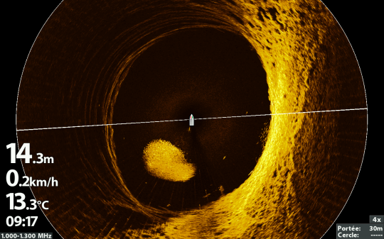
Among the latest technologies to improve fishing, we find Mega 360 Imaging, a technology based on MSI, but at 360 degrees around the boat, this system will allow us to know where the structure is located in relation to the boat and thus cast better on the zone!
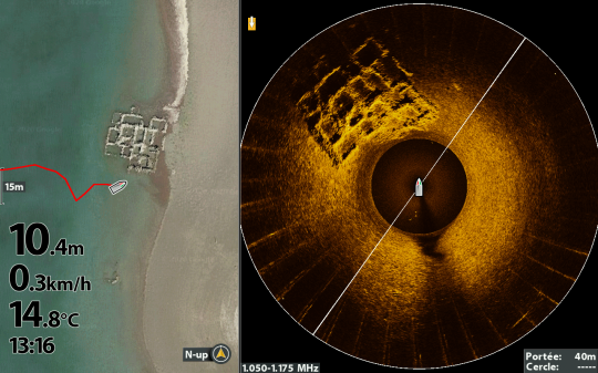
On the 360 Mega Imaging view, we find the ruin on the left front of the boat, so all we have to do is launch in the right direction!
This technology is also used to track schools of fish.
See fish live with Mega Live Imaging probe
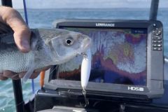
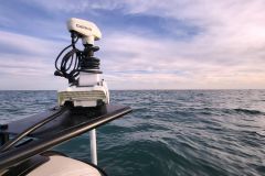
The latest technology is the Mega Live Imaging probe, which enables us to see fish instantly and understand their behavior.
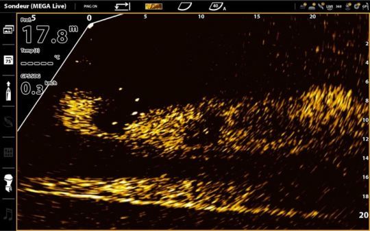
This technology is one of the most widely used at the moment, allowing you to view your lure live and catch fish live.
All these technologies are complementary, and depending on the season and biotope, some will be used more than others.

 /
/ 