The heritage of powerful Maxsea and TimeZero software
TZ iBoat is a complete marine navigation application for iPhone and iPad. It lets you manage navigation and search for fishing spots directly from your phone or tablet. It's not unlike the PC version used by most professional fishermen and large vessels (cargo ships, ferries...) called "TZ Professionnal" (formerly Maxsea). This software has stood the test of time, proving so powerful and comprehensive that even the largest vessels have been using it for decades.
There's plenty of competition in this app market. But the arrival of version 3 of TZ iBoat takes seabed knowledge even further, with a clever collaborative aspect reminiscent of the Waze app on the road.
Bathyvision: ultra-advanced base mapping
TZ iBoat v3 includes a new map called "Bathyvision". While the application is free, the maps are available with an annual subscription fee. Previously, you had to choose between a "raster" map (scanned paper map) and a "vector" map (digital map). Now you take out an annual subscription to TZ Maps, which includes both map formats plus a new, enriched map called "Bathyvision". This map includes HD bathymetry, i.e. a super-precise display of the seabed. By the way, we're curious to know TimeZero's sources, so precise are the fishing spots in certain areas, such as the wreck visible below without any user data added.
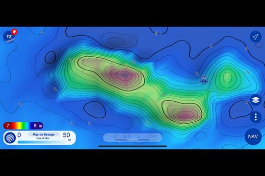
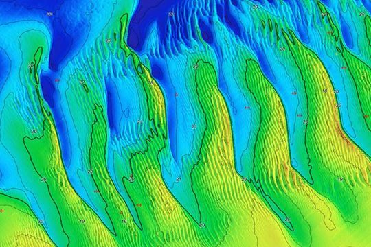
HD bathymetry is within everyone's reach. Of course, it doesn't entirely replace the custom bathymetry data known as PBG, but it really surprised us with the consistency of the original data available as soon as you download the maps. Here's another example with ridens, where every last wrinkle can be visualized.
One-week free trial on iPhone and iPad only
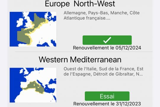
For the curious or the skeptical, no worries. Subscriptions are available on a trial basis for one week, allowing you to confirm whether or not you need this application. Simply download the application from the Store on your iPhone and iPad, then click on the "TZ" button in the top left-hand corner, then the fourth "Store" link. You can then click on TZ MAPS.
The subscription is available for ?40.99 per year. At this price, you can, for example, benefit from huge maps covering the entire Atlantic seaboard, from the Netherlands to Spain, including the south-east of the UK. See examples below.
Community aspect: a "Waze" for marine navigation
In addition to the HD cartography that won us over the most, TZ iBoat incorporates some interesting new features for navigation. In particular, the community aspect allows you to add objects and confirm objects added by other users. For example, a buoy that is not on the map can be added as a map item, visible to other users.
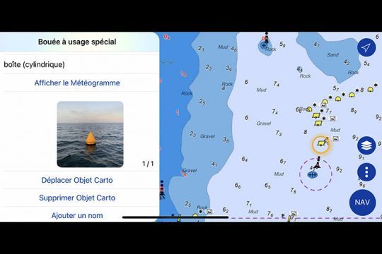
Another useful example for fishing: when you come across a wreck added by another user, the application asks you if the object exists, so you can keep it or not. You can also add a comment or photo. TimeZero's technicians adjust the recorded data according to user feedback. These shared items are new, and are quite distinct from your personal GPS points, which are not shared. Shared points are easy to spot, identified by an asterisk *, as in the screenshot above.
This is a very practical feature for avoiding hazards such as outcropping rocks, buoys and other beacons. For the moment, here are the custom object categories available:
- Obstacles and Navigation
- Beacons
- Buoys
- Marina
- Leisure
This use is reminiscent of the famous Waze software for sharing real-time road data.
Smart Search: search for fishing spots and map features
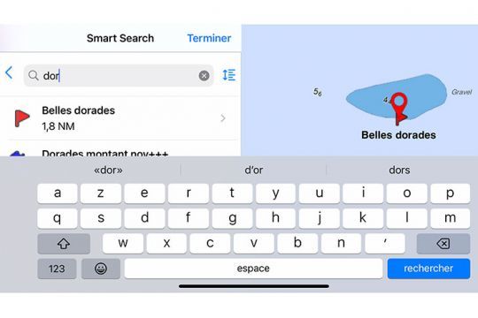
Once you've imported all your points into TZ iBoat, it's sometimes hard to find your way around. Where is this wreck or that rock? Now it's easy to find your points, thanks to a search function that takes you directly to the GPS point in question. For example, in the screenshot below, I search for "dorade" and TZ iBoat shows me all the dorade spots, from the nearest to the farthest. Clever!
Text and icon display adapted to your view
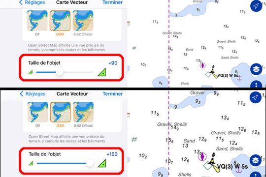
Another interesting feature is that text and icons can be dynamically zoomed in on without disturbing map reading. Those accustomed to "fly-leg" writing can zoom out, and those requiring magnification can zoom in, as in the illustration below.
Safety: dynamic headlight display
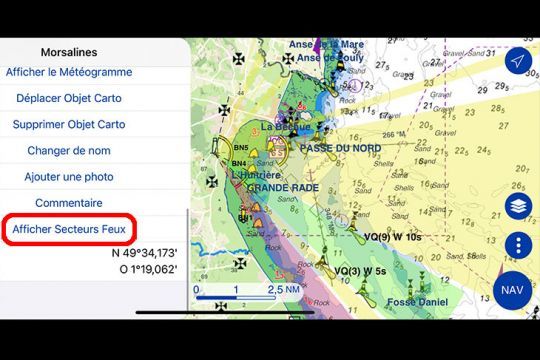
New features include the possibility of displaying the beam of a lighthouse to see if it is visible from our boat. Similarly, in the navigation options, you can be alerted by animated icons when you enter the field of vision of a lighthouse's beam, indicating that you are, in normal visibility, able to see it.
How do I secure my smartphone and tablet on board?
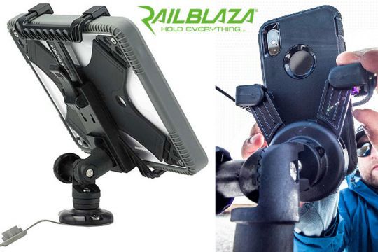
All that's left to do is find the right brackets to hold the phone and tablet in place in hectic conditions. Here's one solution among others, which is very practical thanks to its mobile aspect. RailBlaza brackets allow you to attach and interchange brackets, which can be placed on the console when sailing and on the stern of the boat when fishing, for example.
With this update, TZ iBoat v3 is probably the most complete marine navigation application for iPhone and iPad.
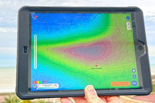
It provides the smartphone or tablet with enhanced, functional cartography for navigation, the technical aspects of which surpass those of certain on-board handsets.

 /
/ 