Prospecting and discovering new areas is a very interesting part of sea or freshwater fishing. Fishing little frequented areas is to increase your chances of finding beautiful fish not used to the presence of fishermen.
The submerged structures are ideal shelters for fish. A whole ecosystem is formed around it. For predators, it is a guarantee to have both food and a relatively safe place to shelter.
Whether in the sea or in fresh water, some structures are easily spotted or known by many people. The fishing pressure is strong, the fish are very solicited and the beautiful catches, either in size or in quantity, are rare. Prospecting will allow you to discover new ones which are either not listed or with an approximate location.
The side view, the perfect tool!
In this case, we will see how to proceed to locate a wreck from an approximate position. Obviously, the procedure will be the same in fresh water.
First, you must locate it and then mark it on the GPS so you can fish it again. To do this, you must be equipped with a fishfinder with the side-view technique. It has different names depending on the brand of your device:
- Scan structure for Lowrance.
- Side Imaging at Humminbird.
- Side Vüe at Garmin.
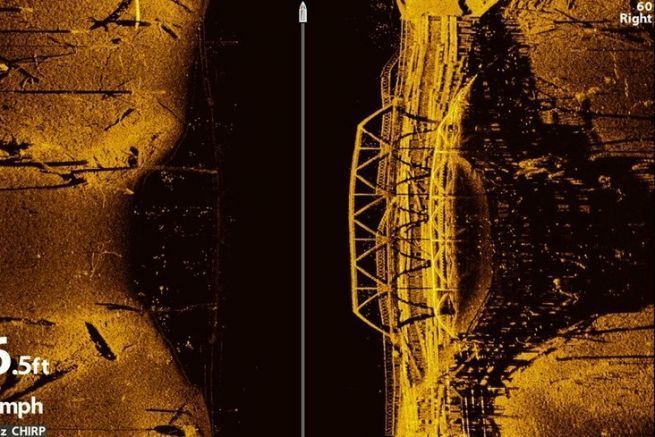
This view allows you to detect underwater structures from the side.
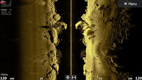
How to proceed?
- The first step consists in passing as close as possible to the structure, with the engine engaged, at reduced speed (less than 5 knots).
On your sonar unit, set your scale so that it is equal to about 3 times the depth. In our case, with a depth of 25 meters, a scale of 75 meters on either side would be sufficient.
You will then see the structure appear, here the wreck! Create two waypoints, one for the bow (front of the boat) and one for the stern (back of the boat). This will allow you to better visualize the orientation of the wreck.
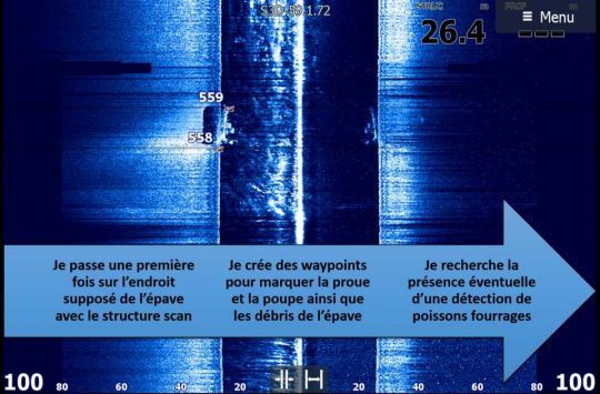
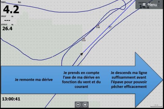
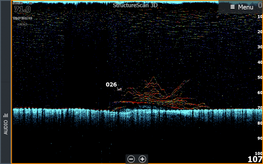
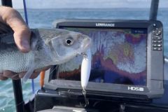
Next, you can switch your sonar to 2D or FishReveal as shown in the image below to better view fish detections.
